The Belgian Ardennes has several rivers where you can kayak or canoe. This page presents three of them: the Semois, the Lesse and the Amblève. It describes the setting of each river, the villages along the way, how the water level changes with the seasons, and the rules of caution and respect that apply everywhere. It does not try to persuade you to go: it gives you what you need to form an idea and, if you wish, to prepare a trip.
This guide is written by the editorial team of this website on tourism in the Belgian Ardennes. The descriptions are deliberately general: conditions on a river change from one week to the next and no page replaces a check on the day itself. Under each river you will find the water level widget supplied by Kayak Belgique, a separate website devoted to kayaking.
Key points
- The water level varies a great deal: check it before choosing a stretch and before setting off.
- A life jacket is worn for the whole trip, even on a calm stretch.
- Respect the banks, the wildlife and the anglers; if you doubt the conditions, postpone the trip.
Before you go: what applies to all three rivers
The water level changes: check it before you go
An Ardennes river has no fixed level. It depends on the rain of the previous days, on snowmelt in winter, on drought in summer and, sometimes, on structures that hold back or release water. The same stretch can be calm and shallow one day, then fast and full of debris a few days later. That is why the water level is the first thing to check, even before choosing a stretch.
A low level does not make a trip dangerous, but it can become slow, with places where you touch the bottom and sometimes have to get out. A high level speeds up the current, makes obstacles harder to see and shortens your reaction time. After heavy rain, the water can rise quickly and carry branches: giving up or postponing is then a reasonable decision. Under each river, a widget shows the water level. It is an indication, not a guarantee, and the instructions of organisers or local authorities take priority.
Seasons and periods of practice
In general, levels are highest in winter and early spring and lowest at the end of summer, but differences from one year to the next are large. Periods of practice, service openings and possible local restrictions vary: it is better to ask the municipality, the tourist office or a provider than to rely on a fixed calendar. The water of an Ardennes river stays cool even after a few warm days, and an accidental fall in is colder than you might imagine.
Safety and general rules
- Life jacket: wear a life jacket or buoyancy aid that fits you for the whole trip, including on calm stretches. Children and people less at ease in water should always wear one.
- Preparation: if you are a beginner, do not go alone, tell someone your route and expected arrival time, and bring a change of clothes in a waterproof bag.
- Obstacles: look out for weirs, dams and marked passages. Follow the signs and the indicated portages rather than attempting an uncertain passage.
- Regulations: recreational navigation on Walloon waterways is governed by regional regulations, and local limitations (periods, stretches, number of boats) may apply. The municipality, the tourist office and providers are the right people to ask.
- Weather: watch the forecast, do not set off in a thunderstorm and do not tackle an obstacle you cannot handle.
Respect for nature, residents and anglers
Ardennes valleys shelter fragile habitats, part of which are protected under Natura 2000. Enter and leave the water at the intended places, do not pull up bank vegetation, take your litter with you and avoid disturbing birds that nest by the water, such as the kingfisher. For the Semois, the page on the wildlife and plants of the valley gives an idea of what can be observed there, from a distance and in silence.
Anglers share the same banks: keep a reasonable distance, stay quiet and leave them room to cast. To learn more about their activity, see the page on trout fishing on the Semois. Banks are also often private property or protected areas: land only where it is intended.
The Semois: meanders and a wooded valley
Setting and landscape
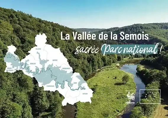
The Semois crosses the south of the Belgian Ardennes, drawing wide meanders in a deep, wooded valley before joining the Meuse in France. Forested slopes, slate rock and stone villages make it one of the most recognisable landscapes in the region. A large part of the valley is recognised as the Vallée de la Semois National Park and designated a Natura 2000 area, with the rules of respect that this implies.
On the water you usually move through a calm setting: slow flat stretches, small weirs and bends where the river goes around a wooded spur. The viewpoints above the valley are best discovered on foot; the itinerary on the page What to see in the Semois valley helps you place them.
Villages and well-known stretches
Kayak trips are generally organised around the villages along the valley, from Herbeumont and Bouillon upstream to Vresse-sur-Semois and Bohan downstream, via Poupehan, Membre and Alle-sur-Semois. Route lengths vary with the starting point: according to the information this site holds, there are descents of 11 to 26 km around Vresse and of 7 to 17 km from Alle. These values are indicative and may change; the provider or the tourist office confirms what is possible at the time.
Water level and seasonality
On many stretches the Semois flows slowly, which makes it easier to approach than a fast-flowing river. That does not excuse you from looking at the level: in dry periods some passages become shallow and progress slows; after heavy thunderstorms or in high water, the current speeds up and the surroundings of the water change. The level of the day largely decides the interest and safety of a trip.
Other activities near the Semois
The valley lends itself to other ways of exploring it. You can walk the GR16 and the hiking loops, ride the RAVeL and the mountain-bike routes, find out about swimming in the river, consider a bivouac in the Ardennes in compliance with the rules, or plan a weekend in the Semois.
The Lesse: limestone landscapes and caves
Setting and landscape
The Lesse owes its character to the limestone it crosses. It runs, among other places, through the cave massif of Han-sur-Lesse, where it goes underground before re-emerging further on, then winds between rocks, meadows and woods before joining the Meuse at Anseremme, on the edge of Dinant. The area is part of the UNESCO Famenne-Ardenne Geopark, a territory recognised for its geological heritage.
Villages and well-known stretches
Descents of the Lesse most often run between Han-sur-Lesse or Houyet and Anseremme, passing villages such as Gendron. According to the information this site holds, routes range from about 12 to 22 km depending on the starting point. As with the Semois, these distances are indicative: the provider or the tourist office tells you what is offered and what is possible on the day you want.
Water level and seasonality
The level of the Lesse directly determines what is feasible: too low and progress through shallow passages becomes laborious; too high and the current speeds up, which can lead to restrictions. In the high season it can be busy on some days, especially at weekends; starting early or going midweek helps you enjoy the calm of the river. As everywhere, local rules and any navigation restrictions should be checked before setting off.
Other activities near the Lesse
A visit to Han-sur-Lesse and its caves is one way to round off a day on the river. In Dinant you can discover the citadel and the banks of the Meuse; to stay overnight nearby, see the campsites around Dinant. The page on outdoors in Wallonia gathers more ideas for outings.
The Amblève: a narrower valley and livelier water
Setting and landscape
The Amblève rises in the east of Belgium and flows westwards, passing among other places Stavelot and Trois-Ponts, then near Coo, known for its waterfall, and on through Remouchamps and Aywaille. It then joins the Ourthe, another major river of the region, which you will find on the page about the Ourthe valley. Its valley is generally narrower than that of the Lesse and its current livelier, which gives the river a more sporting character.
This site does not have a detailed page on the Amblève area: the information below therefore stays general. For local practices, routes and current conditions, contact the municipalities and tourist offices concerned.
Villages and well-known stretches
The places most often mentioned for trips on the water are Stavelot, Trois-Ponts, Coo, Remouchamps and Aywaille. Each stretch has its own features: more technical passages, weirs, dams or portages to respect. On a river with a livelier current, the group's experience and reading the water level matter more, and it is best to seek advice on the stretch that suits your level.
Water level and seasonality
The narrower the valley, the faster the water can rise and fall after rain. The water level is therefore essential information before any trip on the Amblève: a medium level may suit a group, where a high level means giving up. As everywhere, do not rely on a calendar; look at the value of the day and complete it with the indications of the provider or the municipality.
Other activities in the region
To extend a day, the page on outdoors in Wallonia offers ideas, and the page on the wild Ardennes and forest presents the large wooded massifs. La Roche-en-Ardenne, on the Ourthe, is another possible stop, and the guide to Ardennes places helps you locate sites to visit.
How to choose your river
None of these three rivers is better than the others: the choice depends on the water level of the day, the group's experience, the age of participants and the time available. A few general pointers:
- The Semois: meanders, forest and slate villages; often slow current on many stretches; national park setting.
- The Lesse: limestone landscapes, passing near the Han caves, arrival at Anseremme; sometimes busy in the high season.
- The Amblève: narrower valley and generally livelier current; reading the water level and experience matter more.
In every case, look at the water level, find out about local rules and choose a stretch that matches the level of the least experienced member of the group.
Frequently asked questions
Do you need to know how to kayak to paddle these rivers?
On some calm stretches the basics are enough, but it helps to be able to steer your boat, to know the safety rules and to choose a suitable route. Beginners do well to ask a provider or instructor for advice and to wear a life jacket for the whole trip.
How do I find out the water level before leaving?
The widgets on this page show each river's water level as an indication. Public services in Wallonia also publish hydrological data, and the provider or the municipality can explain the situation of the day. In every case, check on the day itself, because the level can change quickly.
When is kayaking possible?
There is no single calendar: it depends on the water level, the weather, local rules and available services. Levels are generally higher in winter and early spring and lower at the end of summer, with large variations from year to year. Ask before you travel.
Can you swim during a trip?
Ardennes rivers are not supervised bathing areas. The current, uneven bed and cold water call for caution. The page on swimming in the Semois describes the precautions; they also apply to the other rivers.
What rules apply on the water and on the bank?
Wear a life jacket, respect signs, weirs and portages, enter and leave the water at the intended places, take your litter with you and keep your distance from wildlife and anglers. Recreational navigation is governed by Walloon regulations and possible local limitations.
In summary
The Semois, the Lesse and the Amblève offer three different settings: wooded meanders, limestone landscapes near the caves, a narrower valley with livelier water. With each one, look first at the water level, because it changes the very nature of the trip, from a quiet paddle to a day better postponed.
If you are considering a descent, take the time to find out: level of the day, local rules, a stretch suited to the group, safety equipment. And if conditions do not look good, another activity in the valley is always possible.
Sources and limits
This page relies on the information gathered on this website and on general knowledge of these rivers. It replaces neither the advice of a professional nor the instructions of municipalities and authorities. The route distances mentioned are indicative.
Checked on by La rédaction d'ArdennenBelgie.be · Methodology
To learn more about kayaking and water levels, a separate website is devoted to it: Kayak Belgique